
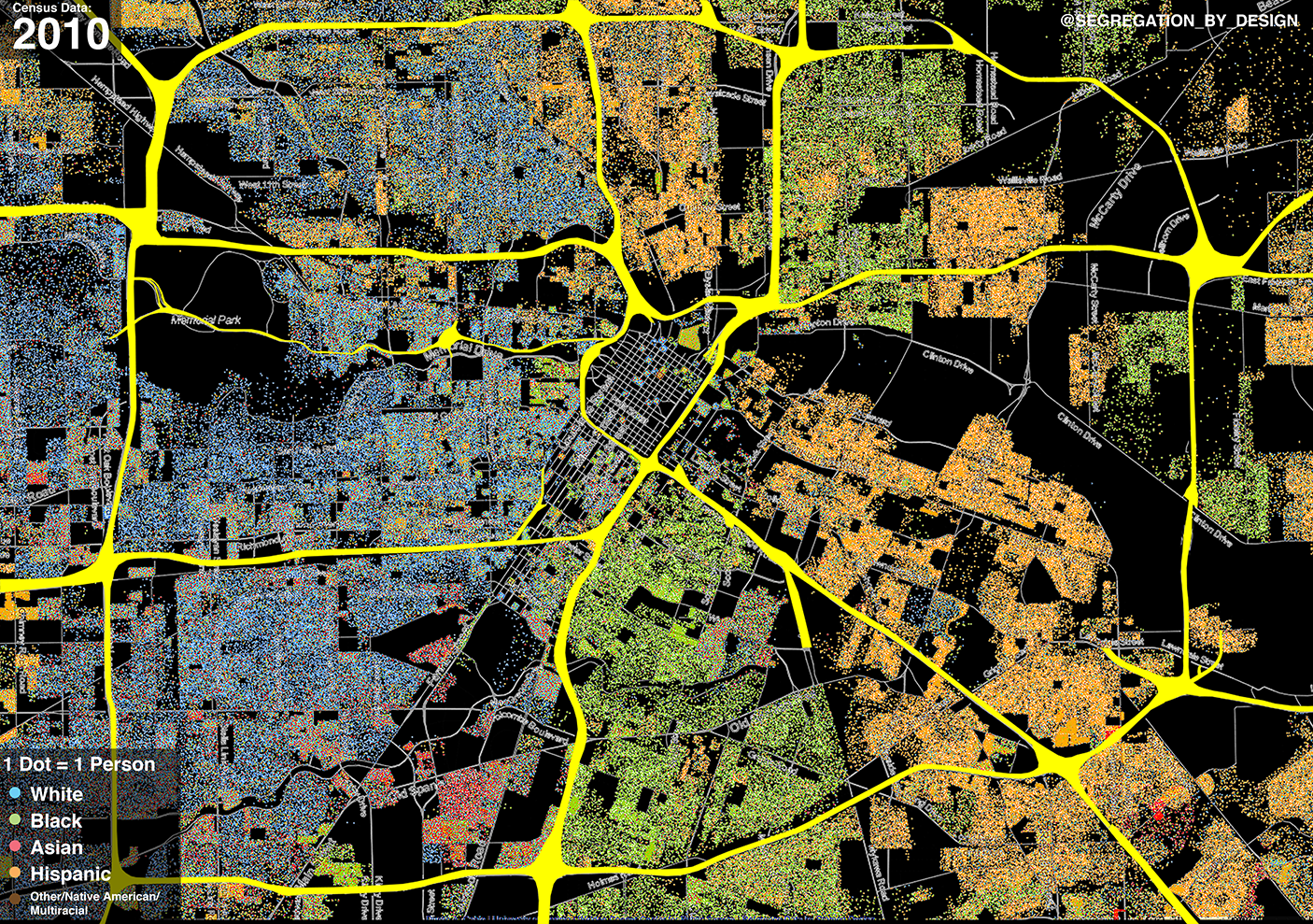
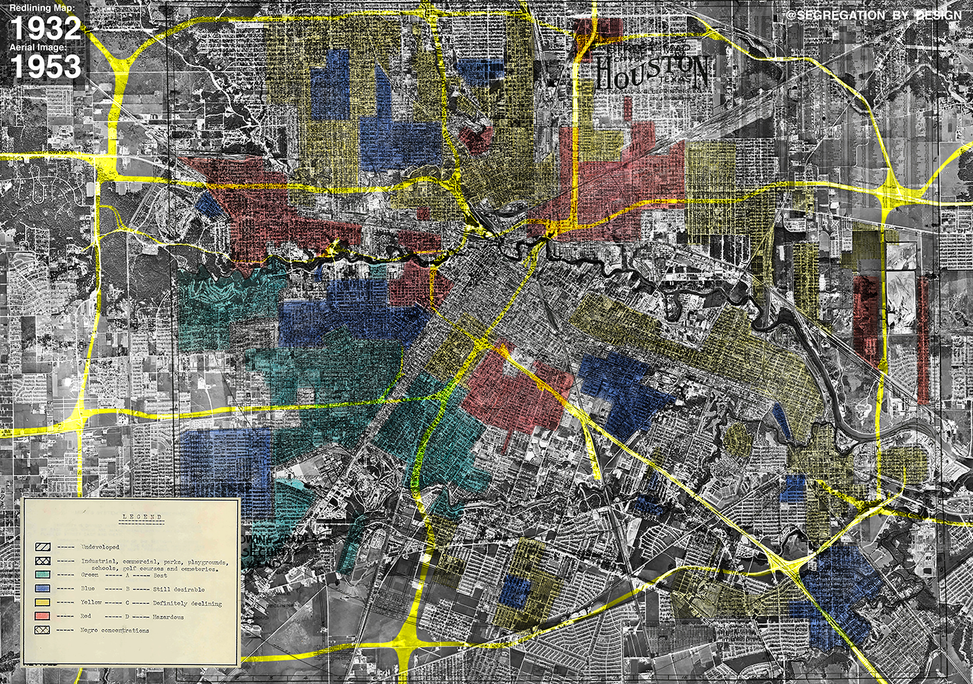
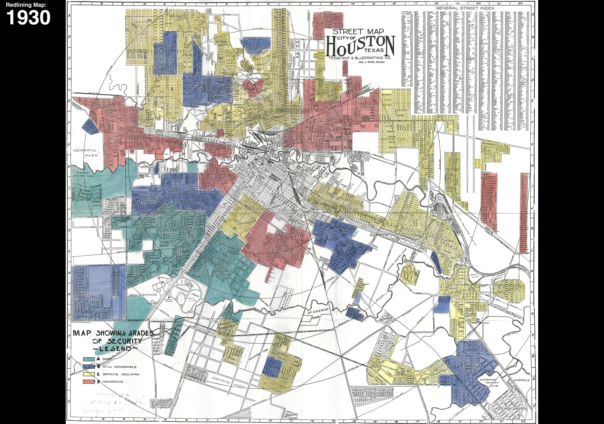
Houston remains sharply segregated, with the freeways acting as barriers between the city’s White, Black, and Hispanic (primarily Mexican-American) populations. These barriers were intentional, many of them following the 1930s redlining map. In fact, if areas on the map with higher “residential security grades” (aka white areas) could be physically separated from areas with lower grades (aka black or hispanic areas), then the banks would value those homes even higher. The freeways provided the government a tool to do just this: the freeways took the red-lines off the map and built them in the real world as massive, exhaust-spewing trenches and elevated structures, separating neighborhood from neighborhood and race from race. Houston’s present-day segregation is a direct result of red-lining and its associated policies.
The red-lined Second and Third Wards, primarily Mexican-American and African-American respectively, had freeways rammed through and wrapped around them, walling these communities off from downtown and displacing thousands. On the redlining map in the second image you can see a rare instance of a freeway cutting through the middle of an area rated with high “residential security.” At the time the red-lining map was created in the 1930s, this had been a wealthy white community. However, due to Houston’s bizarre lack of formal zoning, the city sprawled quicker than most, constructing dozens of white-only suburbs on the periphery of the city, leading to so-called “white flight.” In the intervening years between the creation of the red-lining map and freeway construction, the area had become primarily African-American, an extension of the Greater Third Ward. In the end, it had a freeway rammed through it.
In addition, Houston’s original Chinatown in the northern Third Ward (today’s East Downtown) was decimated during urban renewal, with the vast majority of it being torn down during “slum clearance.” Many of these Chinese-American immigrants moved to a new area far to the west, establishing a new Chinatown on the periphery of the city (outside of the 610 loop).

Previous
Previous
Freeways & Urban Renewal
Next
Next