
PROVIDENCE: REDLINING


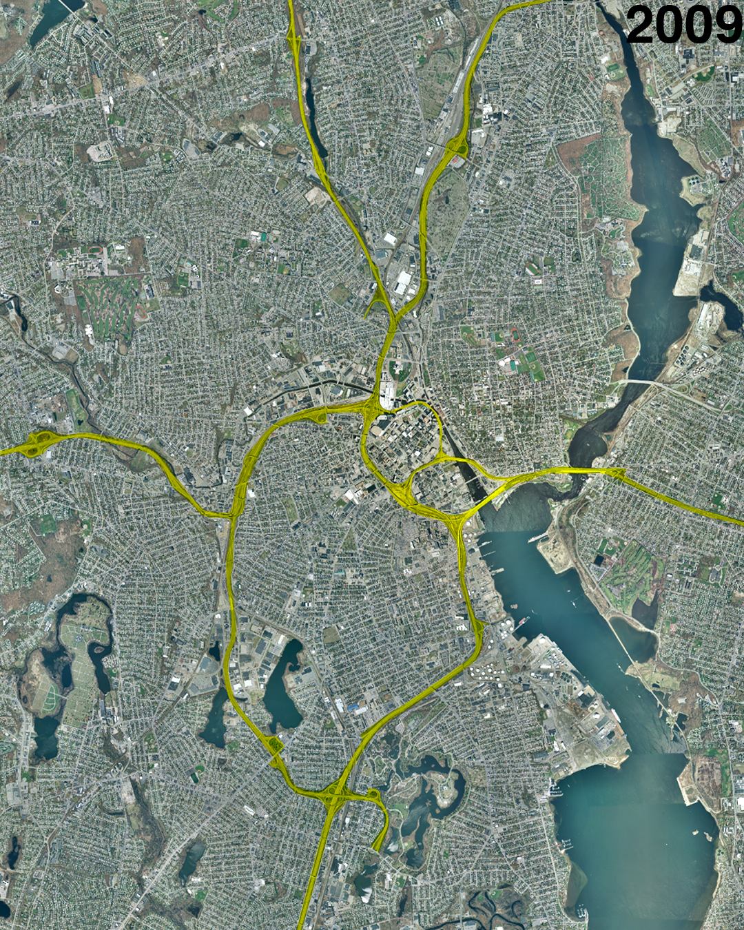
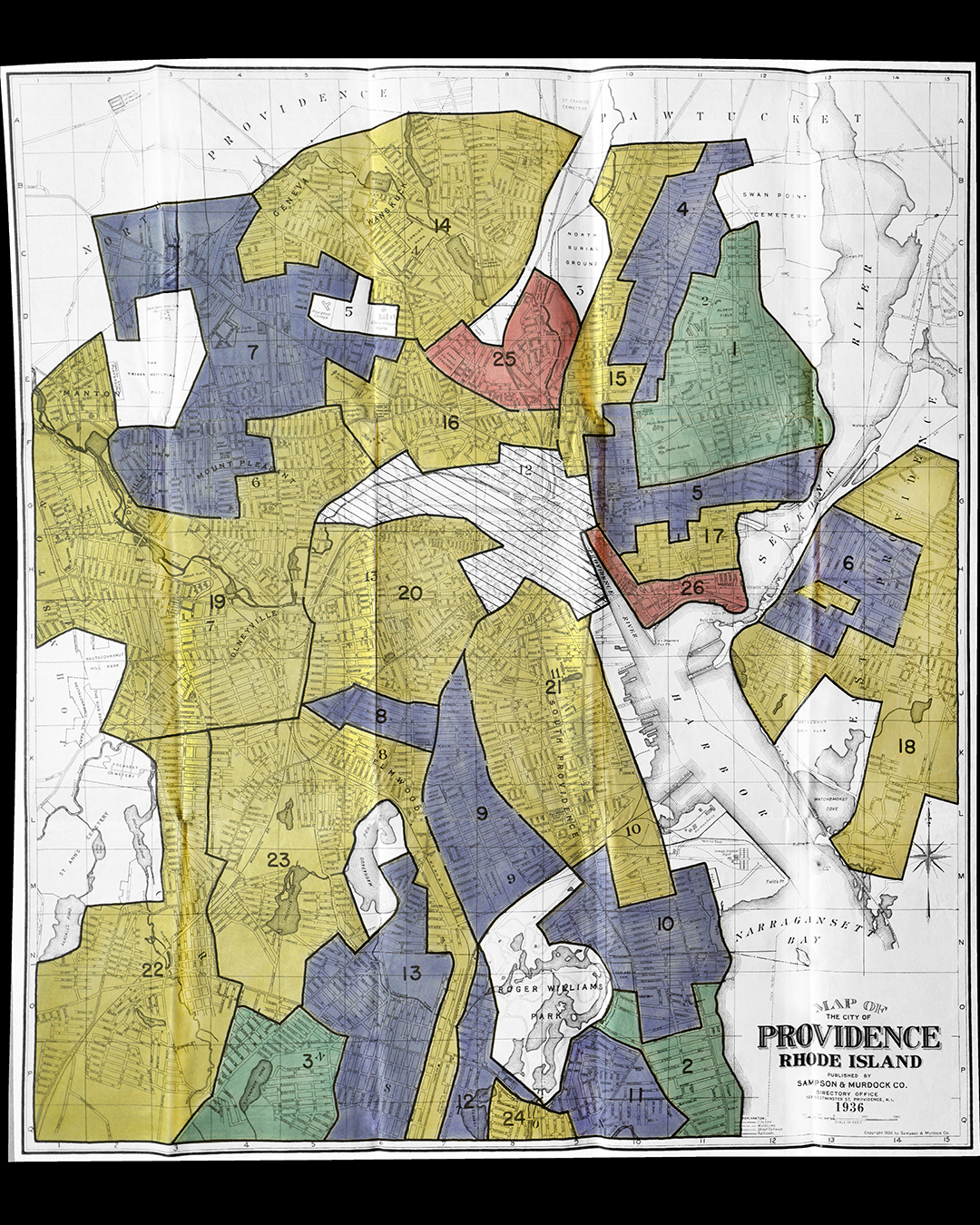
The complete Providence red-lining map (as prepared by the government-backed Home Owners Loan Corporation, HOLC, in 1936) overlaid on aerial images of the city. Downtown was entirely encircled by a freeway and road widenings. In a neighborhood north of downtown (Mount Hope) the red-lined, primarily African-American portion was entirely demolished. It was replaced with a freeway and a USPS distribution office. Despite making up only roughly 5.5% of the total population of Providence in 1960, 33% of those displaced in greater Providence were African-American.
That said, Providence has taken some steps towards fixing the mistakes of urban renewal. It has rerouted the I-195 around downtown, removed the former elevated structure through downtown, and is attempting to repair the grid where the freeway plowed through. In addition, it has "daylighted" portions of the Providence River previously covered by asphalt. However the city still has a long way to go and needs to invest in affordable housing and equitable transit.